NitroNet: Smart System to Quantify Nitrous Oxide Emissions
Nitrous oxide (N2O) is a potent greenhouse gas. With an atmospheric lifetime of 114 years, it is approximately 300 times more effective at heating the Earth’s surface relative to CO2. Nitrogen management for agricultural production of crops, the primary source of N2O, contributes approximately 4% of all greenhouse gases from the United States annually. However, the quantification of these emissions, which are non-uniform in space and time, is a significant challenge at the field and farm scales. Without accurate and precise measurements, accounting of agricultural emissions and optimization of farming practices to reduce emissions is not possible.
NitroNet is an autonomous sensing system designed to monitor N2O emissions over an entire growing season at high spatial and temporal resolutions. By casting a virtual “net” over an entire field, NitroNet identifies areas within a field that produce N2O and when these pulses are emitted to the atmosphere. This project required the development of new, patent-pending mid-IR plastic retroreflectors, the development of the first open-path UAV mounted N2O sensor (utilizing an interband cascade laser), and two identical rotating towers with quantum cascade lasers which scan the field. A specially developed algorithm reconstructs the locations and concentrations of plumes measured by the towers, which are validated by the UAV mounted sensor.
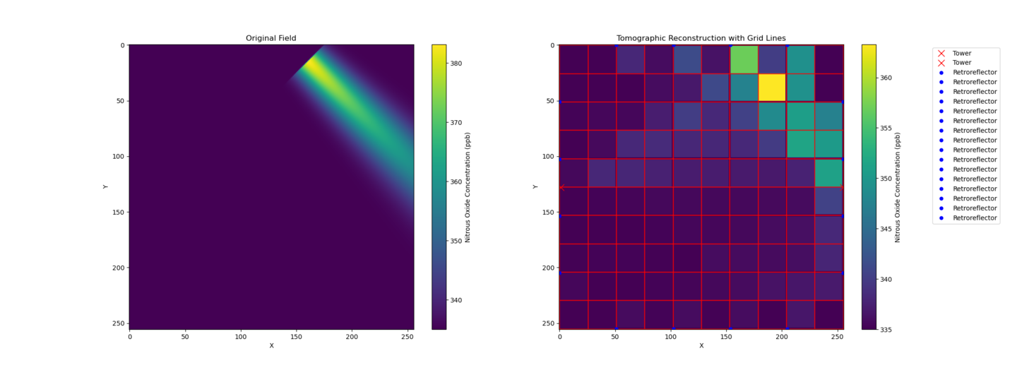
Example of a simulation demonstrating the algorithm's ability to topographically reconstruct hotspots. Credit: Vladislav Sevostianov

Microscopy scan of the plastic Mid-IR retroreflector. Credit: Vladislav Sevostianov

UAV with mounted open-path N2O sensor in flight. Credit: Vladislav Sevostianov

The deployed NitroNet towers, reflectors, and UAV hovering above in a soybean field. Credit: Vladislav Sevostianov
OPALS: Ammonia Measurements via the Open-Path Ammonia Laser Spectrometer (OPALS)
Atmospheric NH3 is one of the most important aerosol precursor species with critical roles in the formation and composition of unhealthy fine particulate matter, nitrogen deposition in sensitive ecosystems, and climate effects through aerosol composition. However, its free tropospheric abundances are poorly known relative to other pollutants such as O3, NOx, and CO because of its low mixing ratios (pptv-ppbv), sampling challenges (e.g. biases from NH3 adsorbing to instrument surfaces, particle volatilization), and high spatiotemporal variability due to its short lifetime (~days).New NH3 instrumentation is needed to generate robust datasets against which to validate satellite measurements over a range of conditions.In addition, high-quality airborne NH3 measurements are needed to quantify the impact of biomass burning on the NH3 budget in the free troposphere, where observations suggest SO4 and NO3 aerosols are fully neutralized.
Our group designed and constructed the OPALS optical cell. OPALS “piggybacked” on the AEROMMA and EcoDemonstrator field campaigns in summer and fall of 2023 before it's official deployment on the NASA ASIA-AQ airborne science mission from Feb-April 2024.

OPALS on the NASA DC-8. photo credit: Yunseo Choi

NASA DC-8 on the tarmac in the Philippines. photo credit: Ryan Boyd
Eddy Covariance
Eddy Covariance is a micrometeorological approach to measuring fluxes driven by turbulence. Sensors have been developed for measuring ammonia and nitrous oxide fluxes and have been deployed for various field campaigns. Because the eddy covariance method is highly demanding on instrumentation, sensor improvement is always ongoing, and various field campaigns are always underway. Most recently, an ammonia system was deployed in Idaho over both the summer and winter, and 2 combined nitrous oxide and ammonia tower were deployed in California.
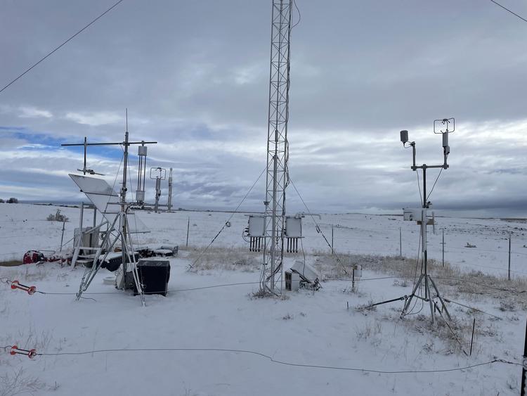
An eddy covariance station using the NH3 sensor deployed in Idaho in the winter. Credit: Vladislav Sevostianov
Seasonal Rhythms of Satellite Ammonia
Atmospheric ammonia (NH3) affects air quality, climate, and biodiversity through aerosol formation and composition and nitrogen deposition into the biosphere. To better understand NH3's impact on air pollution, our group utilizes multiple NH3 datasets, including airborne measurements, ground monitoring network, and satellite retrievals to investigate NH3's spatiotemporal variability at different spatial and temporal scales.
The graph shows one example of our analysis. Monthly, high resolution (~2 km) ammonia (NH3) column maps from the 2008-2017 observations from the Infrared Atmospheric Sounding Interferometer (IASI) were developed across the contiguous United States. Ammonia hotspots, defined as those areas exceeding the 95th percentile of abundances, have a characteristic length scale of 12 km, showing the highly localized nature of ammonia emission sources. Furthermore, large seasonal variations were observed that differed by region, in part due to differences in the dominant types of agricultural activities. Areas with significant animal husbandry had peak column abundances in mid-summer, whereas cropland-dominated regions over the Midwest had spring maxima with shoulder peaks in autumn. A comparison between IASI oversampled NH3 column amounts, ground-monitored NH3 concentrations, and modeled NH3 column concentrations at selected hotspots demonstrates how these new analyses can be used to help constrain spatiotemporal variabilities of emission inventories as well as guiding the locations of future ground-based network sites.
Greenhouse Gas and Ammonia Emissions from Wastewater and Agricultural Waste Systems
This research focuses on the "when", "why" and "how much" of atmospheric methane, nitrous oxide, and ammonia emissions from the agriculture and waste sectors. Current inventories of these emissions in the US rely on limited measurements, and thus are inherently uncertain. Our group employs measurements and techniques that span spatiotemporal scales to build a better understanding of the statistical trends underlying the emissions of these important trace gases in order to scale them robustly to the national level. More recently, the group has become interested in examining these large datasets, in unison, and utilizing machine learning methods to reveal hidden relationships between environmental- and process-level data and measured emissions.
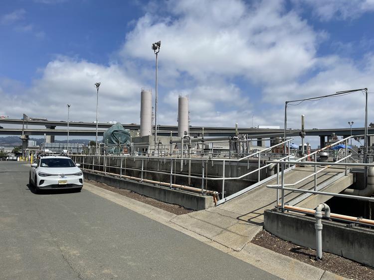
photo credit: Vladislav Sevostianov
